Haven't signed into your Scholastic account before?
Teachers, not yet a subscriber?
Subscribers receive access to the website and print magazine.
You are being redirecting to Scholastic's authentication page...
Subscriber Only Resources
Access this article and hundreds more like it with a subscription to Science Spin 3-6 magazine.
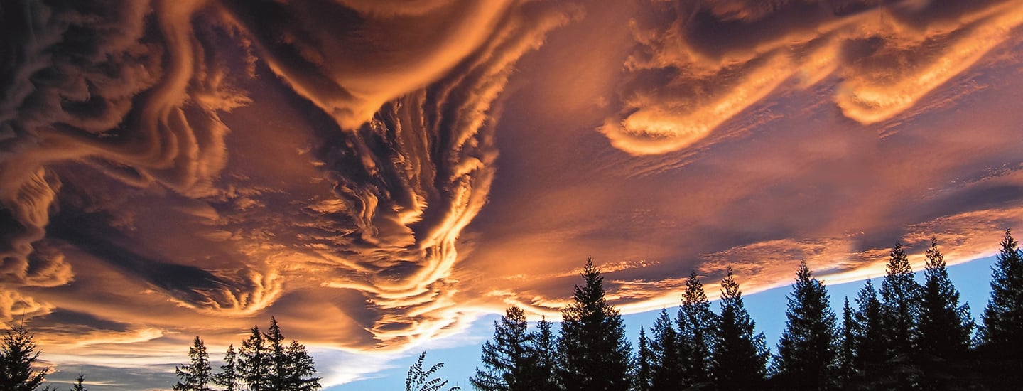
WAV Y CLOUD: Asperitas clouds look and move like ocean waves. They form at the bottom of clouds when cool air sinks within the cloud.
Article Options
Presentation View
Cloud Scientist
A researcher helped to identify 12 new types of clouds.
You’ve probably spent some time looking up at clouds. One might look like a rabbit, another like a car. Meteorologists classify clouds based on their appearance and other features. They record this information in the International Cloud Atlas.
A team of scientists recently added 12 new types of clouds to the atlas. Science Spin spoke with Steve Cohn, the scientist who led the team that gave the atlas its first update in 30 years.
What’s your job like?
Steven Cohn
Meteorologists measure different properties of the atmosphere. These include things like wind, rain, snow, hurricanes, and lightning. We can’t change weather, but we can warn of dangerous conditions. That way people can prepare in advance.
What’s the cloud atlas?
The atlas explains everything you see in the sky. It has information on almost every weather phenomenon, like rain, snow, tornadoes, hurricanes, and even rainbows.
It includes pictures showing cloud types and features. There are more than 100 classifications in the atlas because clouds come in many shapes, arrangements, and textures.
How do clouds form?
Even though you may not see them, the air is filled with water molecules, called water vapor. Water vapor is a gas. As water vapor cools, it changes from gas to liquid or ice and clumps together as clouds. The water droplets are so small and light, they can still float high in the sky.
SKY SPOT: The cavum cloud has a hole where water has evaporated.
Why is it important to classify clouds?
By studying different types of clouds on a given day, we can predict the weather. For example, cumulonimbus clouds are powerful, towering thunderstorm clouds. From a distance, these can be beautiful. But beware, they often mean dangerous lightning, hail, or even tornadoes.
Pilots and sailors, who need to keep a close eye on the weather, rely on the atlas. It’s also helpful to hikers—you don’t want to be caught on a mountain when there’s lightning nearby!
What are some clouds that were added to the atlas?
We added a cloud called volutus. It’s looks like a tube. People have long known it existed—now it has a name.
A feature called asperitas was also added. It means “roughness” in Latin. People around the world were seeing clouds that looked like rough ocean waves in the sky. Now we have a name that describes how these clouds look.
We’ve also given names to clouds that come from human activity. An example are clouds formed by airplanes, commonly called contrails. These clouds are now named homogenitus.
Here are three major kinds of clouds we often see in the sky.
Cumulus
These white, fluffy clouds can be seen on nice days, but watch out! They can quickly be replaced by storm clouds.
Stratus
This type of cloud blankets the sky. They tend to be gloomy and gray.
Cirrus
These are long and wispy clouds. They are made of ice crystals high in the sky.